River of History
 296 miles into my River walk, I am beginning to understand and appreciate the valuable contributions and historical importance of the Mississippi River. This River has helped to shape the United States both physically and culturally.
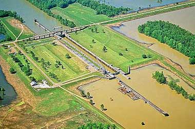
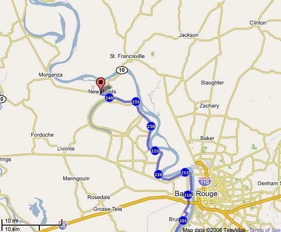
After leaving New Roads, I came across the Old River Lock. Old River is the most amazing site along the entire Mississippi. In a word, the Corps of Engineers are successfully (for now) holding back the Mississippi and preventing it from changing course down the Atchafalaya. Should this change happen, the result would be the destruction of the Atchafalaya ecosystem and the inevitable loss of New Orleans and all the industry along the lower Mississippi. The Mississippi's existing channel would turn into a salt water estuary.
Look at a map of the state of Louisiana and you can see it is shaped something like a boot. Over the course of many millennia the bottom half of that boot has been created by the Mississippi. Southern Louisiana is built entirely of river sediment carried by water from as far away as the Rocky Mountains. As the Jefferson River gushes down a Montana mountainside it picks up little bits of that mountain and carts them off to the Missouri River. As the Wabash flows through prime Indiana farm land it picks up some of that land and carries it to the Ohio River. The process is cumulative until finally, the Mississippi, loaded with two million tons per day of washed away mountain and farm field, reaches sea level and slows down enough to unburden its load in southern Louisiana.
To build up all of southern Louisiana, the Mississippi has had to move around. Every couple of millennia it takes a major turn, abandons it's old channel, and finds a new one. The last time this happened was at the site where Donaldsonville now sits. Bayou Lafourche used to be the Mississippi. The next time this will happen will be at Old River.
And the next time that will happen I’ll hopefully be further north along the Mississippi and away from Old River.
Since leaving the Old River Lock, I’ve been heading north to Vidalia, by walking along Highway #15 which climbs on top of the levee, on the side, at the foot of, or near the levee, passing through miles and miles of plantation country.
As I walk through this rich agricultural countryside dotted with an occasional building complex, I try to imagine that at one time these fields provided cotton that was loaded onto ships, that floated down the Mississippi to New Orleans where it was transferred to ocean-going vessels that sailed into eastern ports or across the Atlantic. This region, like many others in the South, traded agricultural crops for manufactured goods. During the early 19th century it was of enormous interest to this region not to have tariffs on imported manufactured goods from Europe. With the Tariff Act of 1828 (known as the “tariff of abominations), discontent broke out in the South and the seeds of the Civil War were planted.
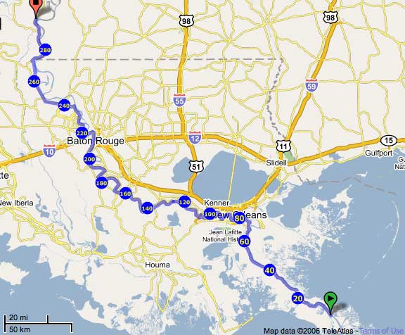
I’ll be in the small town of Vidalia soon. This is where I’ll cross the River for the third time, leaving Louisiana behind and entering into Mississippi.